This is an old revision of the document!
 <html><center></html>
<caption>Martenet's Map of Howard County, Maryland : drawn entirely from actual surveys</caption>
<html></center></html>
<html><center></html>
<caption>Martenet's Map of Howard County, Maryland : drawn entirely from actual surveys</caption>
<html></center></html>
 <html><center></html>
<caption>Pictorial History of the Civil War in the United States of America By Benson J. Lossing</caption>
<html></center></html>
<html><center></html>
<caption>Pictorial History of the Civil War in the United States of America By Benson J. Lossing</caption>
<html></center></html>
 <html><center></html>
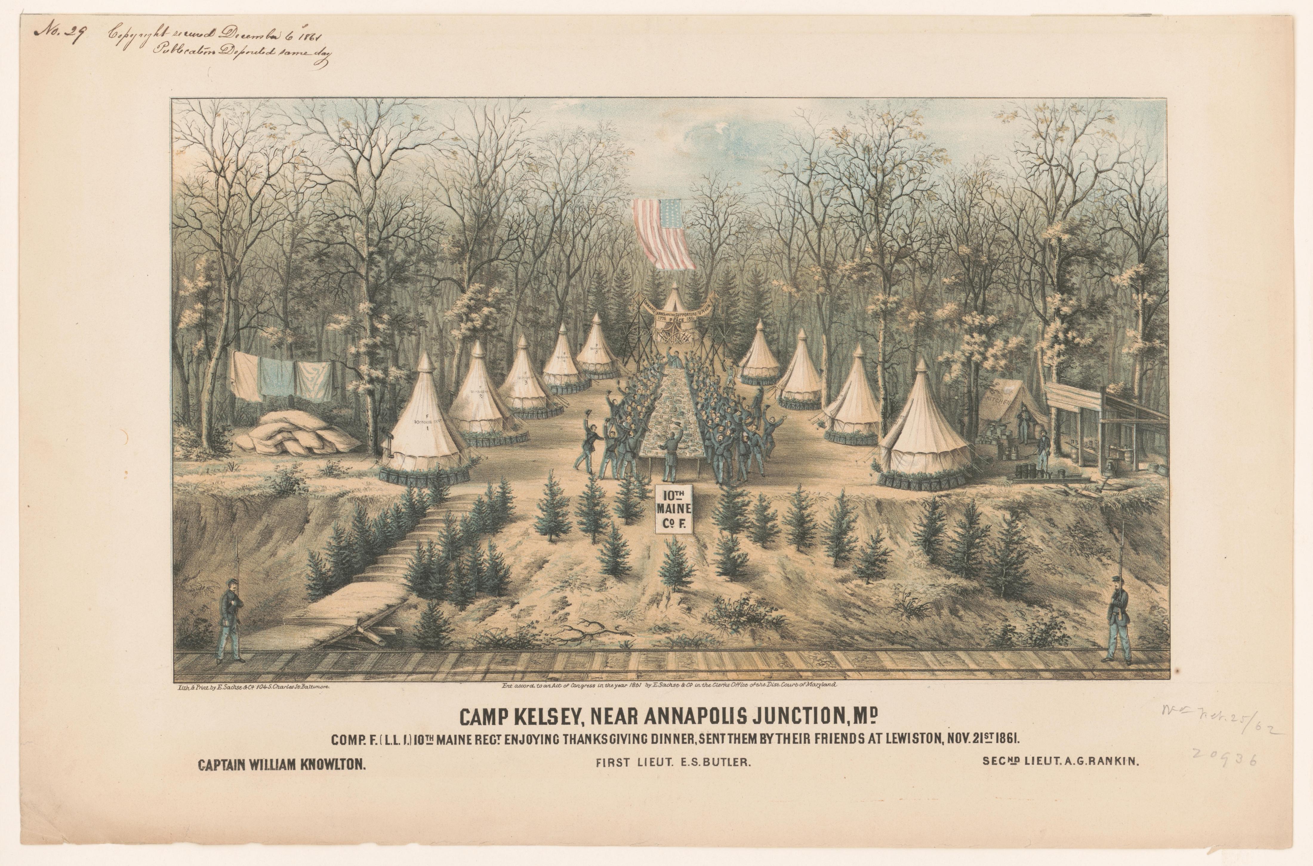
<caption>Camp Kelsey, near Annapolis Junction, Md, Sachse (E.) & Co., LC-DIG-pga-08130</caption>
<html></center></html>
<html><center></html>
<caption>Camp Kelsey, near Annapolis Junction, Md, Sachse (E.) & Co., LC-DIG-pga-08130</caption>
<html></center></html>
 <html><center></html>
<caption>Annapolis Junction, on the Washington branch of the Baltimore and Ohio Railroad, in possession of the troops of the United States government. LC-USZ62-90547</caption>
<html></center></html>
<html><center></html>
<caption>Annapolis Junction, on the Washington branch of the Baltimore and Ohio Railroad, in possession of the troops of the United States government. LC-USZ62-90547</caption>
<html></center></html>
 <html><center></html>
<caption>An Illustrated history of Fort George G. Meade.</caption>
<html></center></html>
<html><center></html>
<caption>An Illustrated history of Fort George G. Meade.</caption>
<html></center></html>
 <html><center></html>
<caption>An Illustrated history of Fort George G. Meade.</caption>
<html></center></html>
<html><center></html>
<caption>An Illustrated history of Fort George G. Meade.</caption>
<html></center></html>
 <html><center></html>
<caption>Annapolis Junction Hospital, Annapolis Junction, Md. LC-DIG-pga-08118</caption>
<html><center></html>
<html><center></html>
<caption>Annapolis Junction Hospital, Annapolis Junction, Md. LC-DIG-pga-08118</caption>
<html><center></html>
 <html><center></html>
<caption>CAMP BUTLER,/ANNAPOLIS JUNCTION, MD./MAY 2d-11th 1861./- -/THE FIRST CAMP IN ACTIVE SERVICE,/OF THE FIFTH REGIMENT N.Y.S.N.G</caption>
<html><center></html>
<html><center></html>
<caption>CAMP BUTLER,/ANNAPOLIS JUNCTION, MD./MAY 2d-11th 1861./- -/THE FIRST CAMP IN ACTIVE SERVICE,/OF THE FIFTH REGIMENT N.Y.S.N.G</caption>
<html><center></html>